Hamburger Hochbahn
GIS-supported evacuation of subway trains


The Challenge
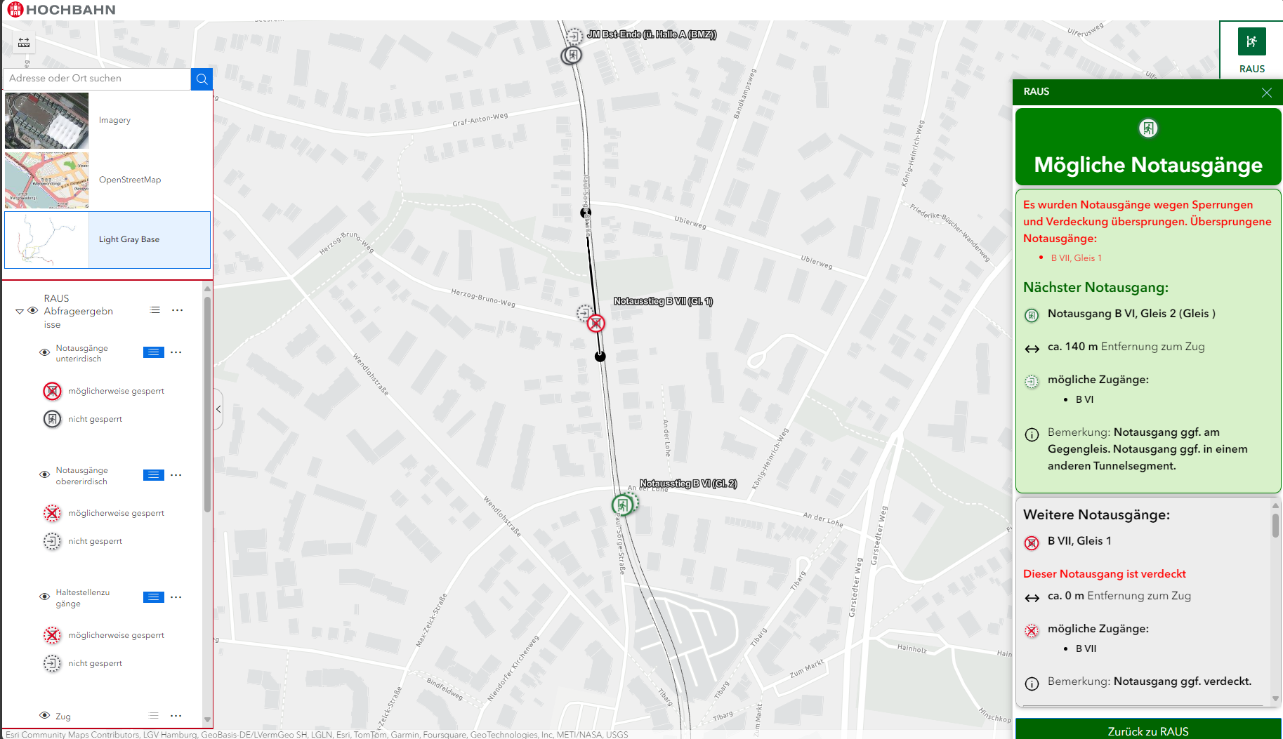
A subway train getting stuck on the track and needing to be evacuated is a rare but critical emergency. For such instances, a safe and efficient support solution for the control center staff to coordinate the evacuation should be implemented. This requires fast and precise positioning of the train, which makes it possible to direct the approaching emergency Services to the nearest above-ground and underground
track access points with travel instructions. The functionality of the positioning must be robust under shifting conditions – such as covered or blocked emergency exits, evacuation obstacles, bi-directional train operation, or partially incorrect data. Because of the infrequent use case and the need to act in a stressful situation, intuitive usage of the application and embedding in existing Workflows and systems is of particular relevance.

With RAUS, we have a modern, reliable tool that helps our control center in critical situations to make the right decisions. For this type of use case, it is extremely important for us to have a professional and innovative manufacturer with a great deal of experience such as con terra.
The customer
The Hamburger Hochbahn AG (HHA) has been a pioneer in future-oriented mass transit since 1911. As the largest transportation company in Hamburg, it operates the Hamburg subway and a large portion of the city bus network. The elevated train is wholly owned by the Free and Hanseatic City of Hamburg via the HGV Hamburger Gesellschaft für Vermögens- und Beteiligungsmanagement mbH and is one of the largest local Transportation companies in Germany, and the largest provider in the Hamburger Verkehrsverbund (HVV).
The solution
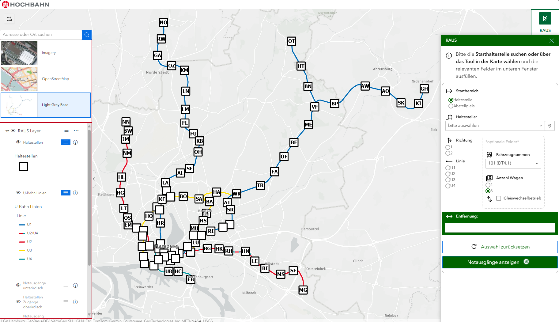
To ensure simple and intuitive operation, multiple interviews were carried out with individual control center staff, and assessed at the start of the project using User-Centered Design (UCD) methods. Based on the userspecific requirements, tailor-made designs were created and evaluated again.
Based on this, a Java script-based web application was developed that was integrated into the existing ArcGIS Enterprise-based Hochbahn-Geoportal. The development was built on the ArcGIS Experience Builder, including development of a special custom widget for emergency localisation. The positioning of the train happens on the server side in a Python-based geoprocessing service. To do so, this service retrieves the necessary geodata, such as track kilometres, from the Enterprise geodatabase.
The benefit
The robust and – depending on the information contained in the entries – precise positioning under varying conditions supports a rapid, safe evacuation in an emergency. Thanks to the close cooperation with the users during the entire development process, a solution was created with intuitive Usability and a high degree of user acceptance that leads to the desired result in a simple and error resistant fashion, even in stressful situations. The selected System architecture offers a high-performing, robust and easily upgradeable solution which has been fully integrated into the existing system landscape of the Hamburger Hochbahn.
The solution is based on
ArcGIS Enterprise
ArcPy-based geoprocessing functionality
ArcGIS Experience Builder with customer-specific custom widget
Summary
Tailor-made, light-weight solution for the use case
Complete integration into the existing Esri system landscape of the HHA
Aggregation of relevant information from various data sources, such as survey data and operational information
Positioning of the trains via attributes (no comples network topologies)
UCD application: user-centered development from the start
Easily upgradeable in terms of additional tasks and use cases
