Swissgrid AG
Evaluation of ArcGIS Utility Network Usage


The Challenge
The project goal was to evaluate whether Esri’s ArcGIS Utility Network meets Swissgrid’s requirements for a future-proof spatial asset management system.
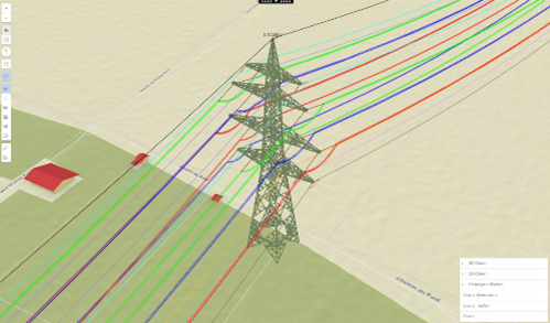
The current system is based on a specialized solution using ArcMap and Geometric Network, representing the high-voltage network of overhead lines, underground cables, and other network objects. Data collection for underground cables is done manually using survey sketches, while overhead lines are regularly flown over, with data subsequently structured using automated FME processes. All geodata in Swissgrid’s system is regularly checked for accuracy through automated quality checks, also conducted using FME processes.

Through our professional collaboration with con terra, we successfully conducted a comprehensive evaluation of the Esri ArcGIS Utility Network for our asset management. The tailored consulting approach, exceptional expertise, and solutionfocused methodology provided us with valuable insights for future decision-making. We were particularly impressed by the efficient integration of our existing processes and the customization of the data model to meet our specific needs. Overall, it was a highly successful proof of concept that fully met our expectations.
The Customer
Swissgrid was founded in 2006 in response of the gradual opening of the Swiss electricity market. Since 2009, Swissgrid has been responsible as the national grid company for the operation, safety, and expansion of the 6,700-kilometer extra-high-voltage grid. Swissgrid took over the grid in 2013, which represented an important milestone on the path towards electricity market liberalization.
Swissgrid is playing a key role in the energy transition and collaborates with various stakeholders to expand the Swiss transmission grid sustainably and efficiently. For supply security, networking within Europe is crucial, with Switzerland serving as a central electricity hub.
The Solution
For the proof of concept, Esri’s ArcGIS Electric Utility Network Foundation Solution was chosen as the basis to reduce the effort required for data model configuration and to assess feasibility. Throughout the project, con terra and Swissgrid worked closely together, conducting regular online workshops. con terra contributed extensive expertise on data structure and Utility Network functions.
Together, relevant Swissgrid objects were mapped to the Esri data model, prioritizing objects relevant to the proof of concept. The data model was extended with additional object classes and rules, while requirements for data migration using FME were thoroughly analyzed and documented.
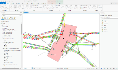
Subsequently, a prototype implementation into the target environment of the Utility Network was carried out based on an Esri File Geodatabase. A proof of concept environment was set up, and an asset package for configuration and data import was prepared. After successful configuration and setup of FME workspaces, the Utility Network was created, and ArcGIS analysis functions were successfully applied to the migrated Swissgrid data.
The Advantages
Through comprehensive ArcGIS Utility Network expertise and consulting support from con terra, Swissgrid has gained the necessary knowledge to independently conduct further evaluations and make informed decisions for the future direction of their system. This positions Swissgrid to advance their strategic planning and optimally develop their spatial asset management system.
The Solution is Based On
ArcGIS Pro
ArcGIS Electric Utility Network
FME Form und FME Flow
The Outcome
The chosen consulting approach and successful evaluation provided a solid foundation for future system decisions at Swissgrid. By adapting the ArcGIS Electric Utility Network data model to Swissgrid’s specific requirements, targeted and valuable insights were gained.
In detail, the following aspects were successfully evaluated:
• Application possibilities of ArcGIS Utility Network
• Adaptation and continued use of existing import interfaces
• Expandability and adaptability of the data model for the high-voltage network
• Use of ArcGIS standard functions for Swissgrid in documentation, analysis, and reporting
