
Transparent operational and usage monitoring for Geo-IT infrastructures
service.monitor enables administrators to collect, store and visualize data on the performance and usage of a GIS infrastructure. With this holistic overview, important decisions can be made in such a way to derive maximum benefit from the infrastructure. Best of all: whether ArcGIS, FME, con terra Technologies or OGC services, service.monitor is an all-round talent.
Systems can be continuously checked with service.monitor. The health check, for example, provides always up-to-date information about the availability of FME engines, ArcGIS services or SOC processes. The best thing is that you can be notified of what is important – via the channel of your choice.
By bringing together monitoring and log information from the entire architecture, service.monitor provides a central point of contact for monitoring, analyzing and interpreting the entire system operation.
Modeling user behavior creates an understanding of how apps and map services are used. This enables more efficient forward planning and quick reactions to emerging problems. In this way, the long-term success of the solution can be guaranteed.
Monitoring – Quality Assurance for Geo-Services
Monitoring and oversight form a safety net for operating a Geo-IT solution. Thanks to periodic checks of the availability of services and applications, and appropriate alerts, problems that arise can be solved promptly. service.monitor supports a wide range of Geo-IT services (e.g. OGC, ArcGIS, FME). In addition, individual queries on the collected operational data can be used as triggers for administrative warning notifications.
Operational data and logging
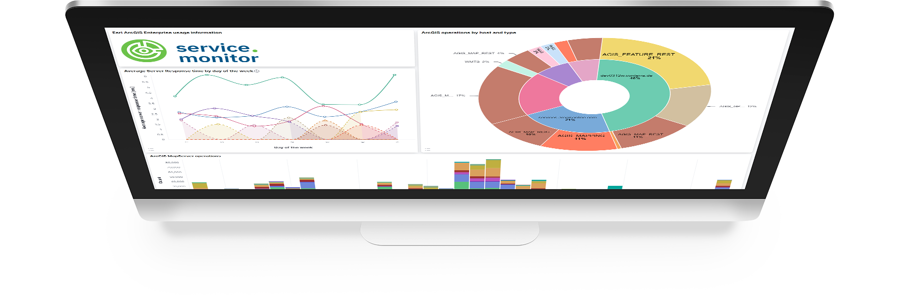
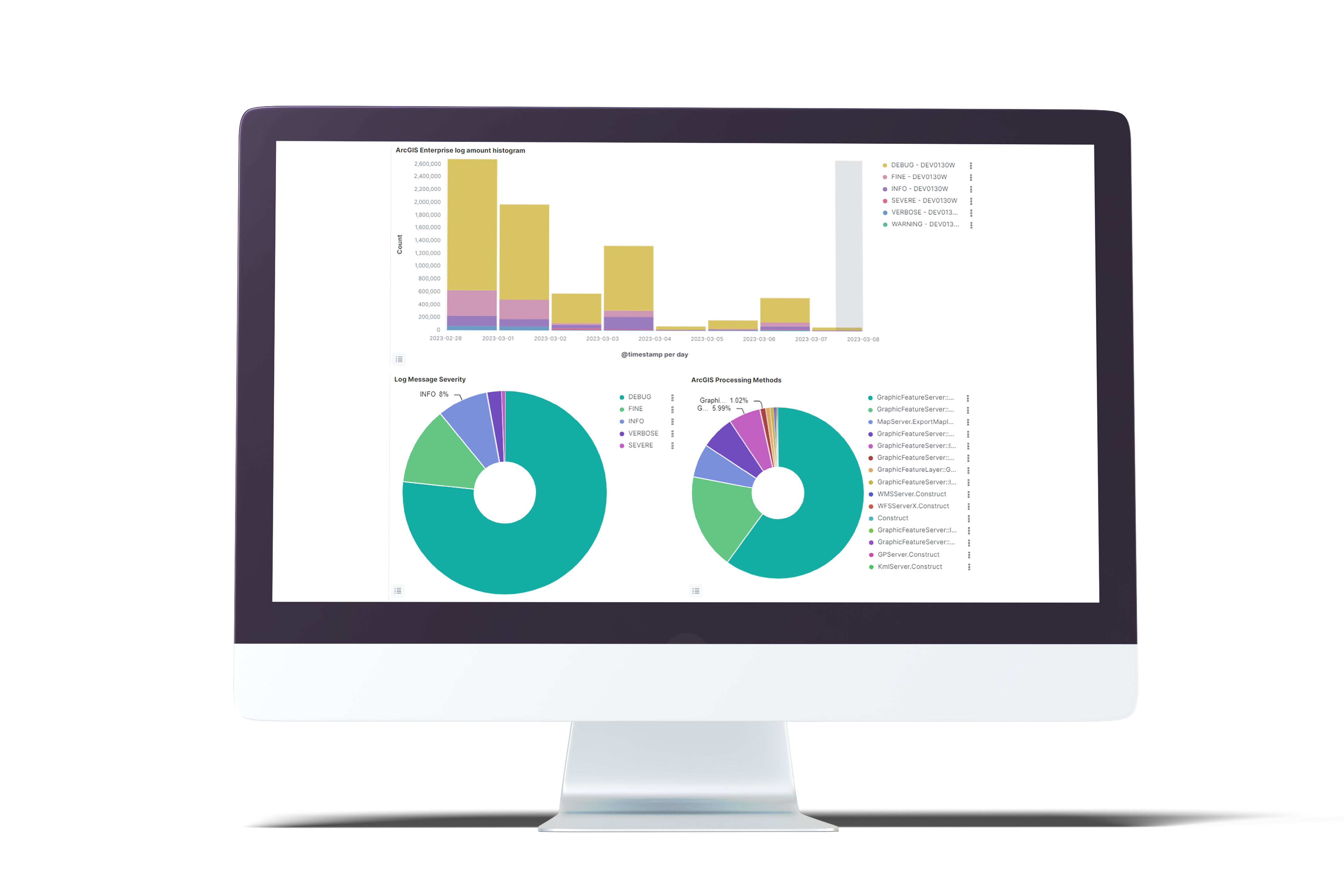
Operational data and logging from almost all sub-components of the Geo-IT solution are accessible in one place: This enables a transparent all-round view and convenient, comprehensive access to information with operational relevance. The information helps with commissioning, real-time assessment of ArcGIS Server workloads, and tracking activities across different software products.
- Aggregation of many Geo-IT infrastructure operational data
- Convenient search and filter options
- ArcGIS Server workload analysis
Analytics and usage behavior
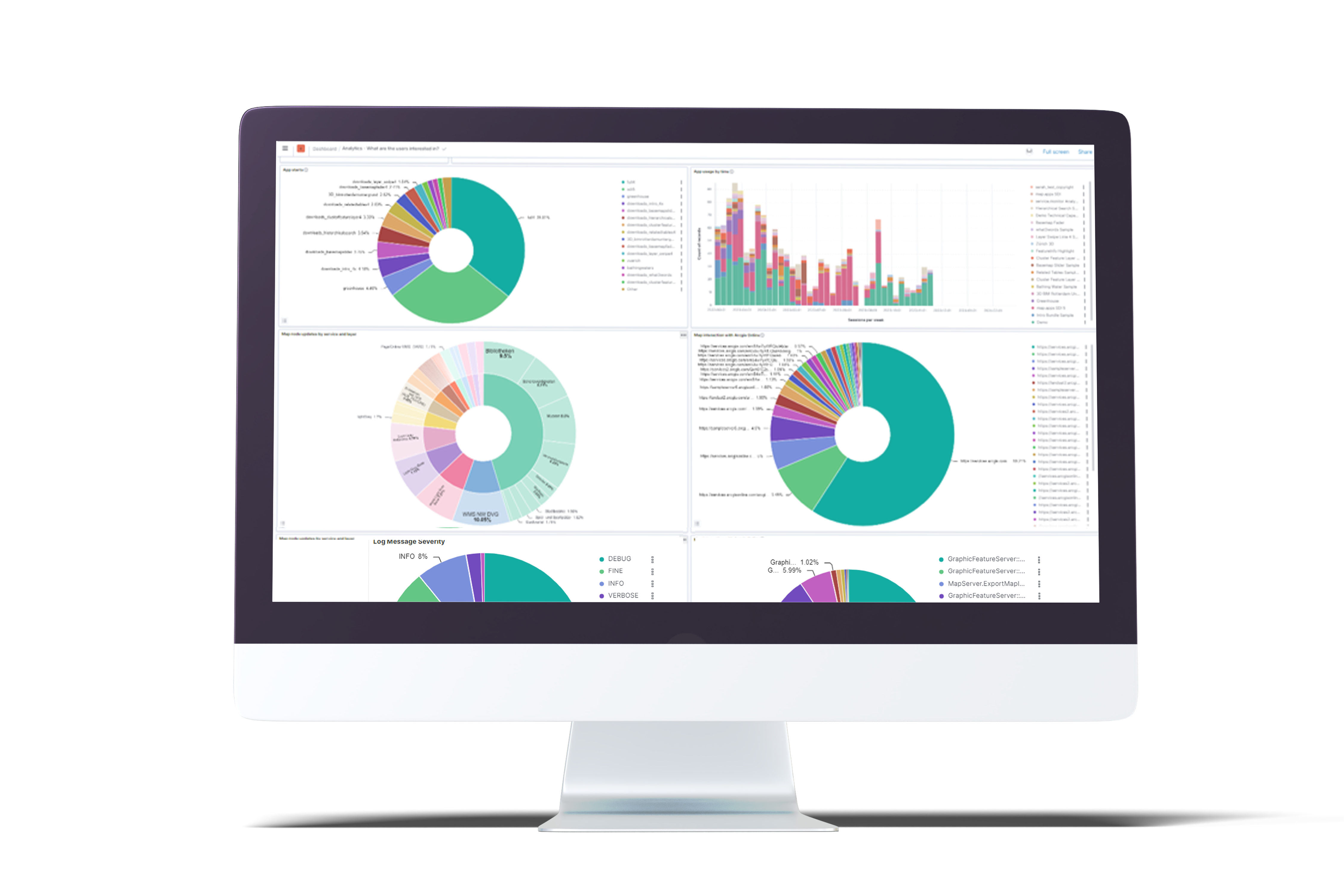
Data on the usage of a Geo-IT infrastructure says a lot about its acceptance and success. They help to match expected with actual usage. Based on this knowledge, decisions can be made to make your solution better. Analytics data on usage behavior is collected by service.monitor explicitly (e.g. in map.apps) or derived from collected data (e.g. ArcGIS Enterprise).

Use cases and examples
Notify me when map service is down.
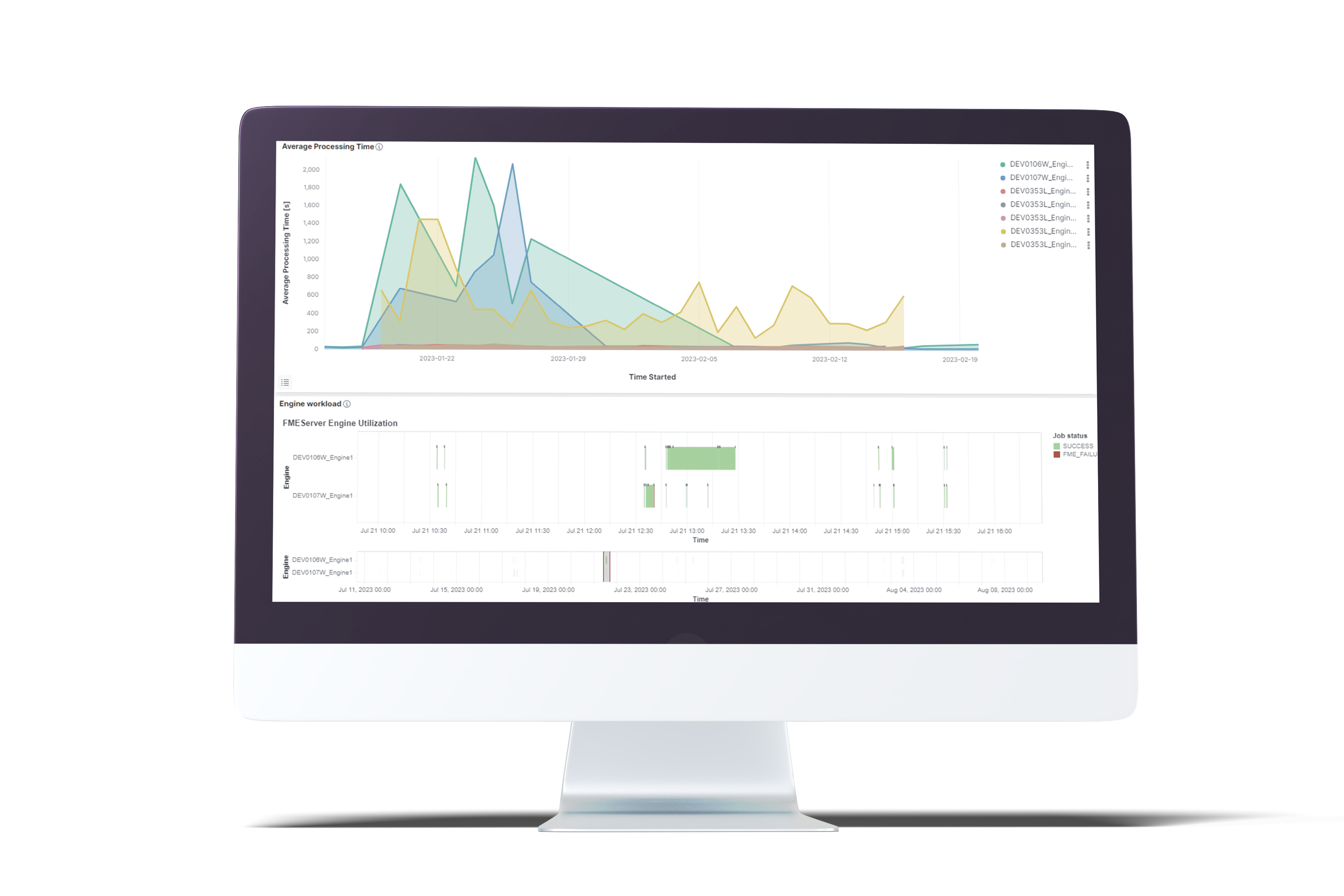
What is the workload of my FME engines during the day?
How many failed Portal for ArcGIS login attempts have there been?
What is the utilization trend of my ArcGIS server in the last six months?
How many users are using each map.apps application?
How many timeouts were produced in my ArcGIS landscape?
Has the FME job been successful tonight?
Download Section
Distributors